A few minutes ago our anemometer recorded a 44.6 mph gust and the wind is regularly blowing over 30 mph. Yikes, we had to pull our room slides in and can do nothing but wait it out. A number of tents here have been knocked flat and we actually saw one floating down the Colorado River. While the wind is bad enough, we also have a layer of fine, gritty dust covering everything inside the RV and car. Though barely visible, this dust feels like sandpaper when we slide something across a counter-top or table surface.

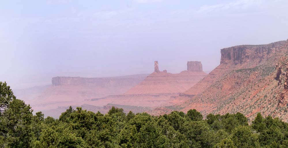
A dust storm during today's drive, which took us through Castle Valley as recommended by the
Bayfield Bunch.
Visibility in Castle Valley was not too good today, but it was still one of the best Sunday drives we've made.


We love the open range grazing out here. Sometimes you just have to wait a bit while a couple calves catch up with their mother.

The beautiful Aspens, pines and snow covered peaks. It just doesn't get any better than this.

On the way back we stopped at the Moab Arts Festival. One of the performances included this Lion Dance by a Martial Arts group from Colorado.

The finale for the Martial Arts performance was this instructor lying on a bed of nails with 200 lbs. of concrete blocks on top of him.

The concrete blocks were then smashed with a sledge hammer, unbelievable! If I had seen this on TV, I would have thought it to be a hoax.
 The mountain stream is beautiful and has to be crossed several times.
 Sometimes the trail led us into deeply wooded shade. There was lots of poison ivy to watch out for too.
 Sometimes the trail follows riverbed ledge rock and rim rock too.
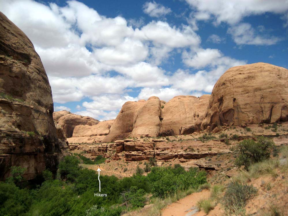 Click on this photo to get a sense of scale.
 The trail sometimes required some rock climbing as well.
 Morning Glory Natural Bridge up ahead. Once we got to the bridge we found it difficult to get a good photo.
 The canyon comes to an end right under the natural bridge. It's a cool, cave-like environment where a lot of hikers like to hang out before heading back to the trail-head.